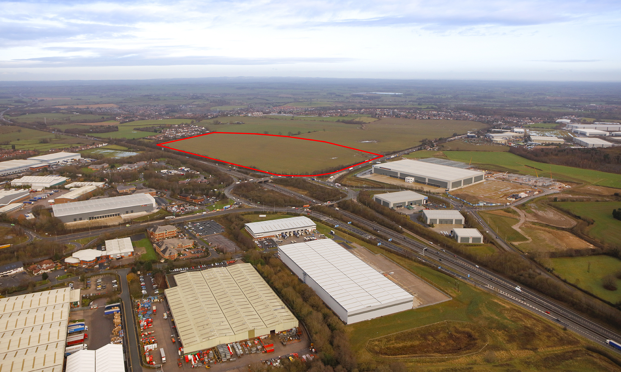
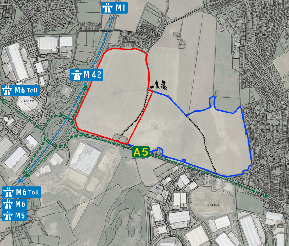
Site Location Plan

The development site (shown in red) currently comprises approximately 32 hectares of arable farmland on the north-eastern quadrant of Junction 10 of the M42 motorway. It forms part of a much larger 73 hectares land ownership north of the A5 between Dordon and Tamworth – illustrated by the red and blue areas combined on the Site Location Plan. This additional land has allowed Hodgetts Estates to take a wide reaching approach to access and landscape measures.
Site surrounds
At present, the site is mainly in agricultural use and farmed each year on a crop rotation. As such, the monocrop nature of the of arable farming is not conducive to extensive faunal and/or floral diversity. The proposals seek to preserve and maintain the faunal and floral diversity that does exist and provide significant enhancements.
A number of public rights of way (footpaths and bridleways) are located in and around the site, linking it to Core 42 Business Park and Birch Coppice Business Park to the east (public footpath AE46), as well as Birchmoor to the north and St Modwen’s Park to the south (public bridleway AE45). However, these are poor quality raised single lane farm tracks which have grassed verges and banks down to the fields on each side. The proposals incorporate significant enhancements to these routes as well as new footways/cycleways, both within the site and its wider rural setting which would improve connectivity for commuters as well as provide access to the countryside for the local community for leisure purposes.
The site lies within what is proposed to be designated as a new Strategic Gap between Tamworth and Polesworth and Dordon in the emerging North Warwickshire Local Plan. In light of this, the approach to landscape matters has been of paramount importance to the design concept – details of the landscape strategy is set out on the Key Topics page. In the context of North Warwickshire, the site lies in the northern half of the Borough, outside of the Green Belt which covers approximately 60% of the Borough.