Why logistics and industrial in this location?
Recent research published by industry experts identifies record levels of ‘take up’ of logistics and industrial buildings in the West Midlands over recent years (exacerbated by COVID-19), which has eroded the supply of available land and buildings across the region to an all-time low. Research undertaken on behalf of Hodgetts Estates indicates that the area with the most acute shortage of logistics and industrial land/buildings is along the M42/A5 corridors.
The M42 and A5 corridors have been identified as key growth corridors for strategic employment sites across the West Midlands. In May 2021, the West Midlands Strategic Employment Site Study, which was undertaken at a regional level, scored this site the best out of some 50 sites assessed across the region, in terms of its suitability to accommodate this identified need.
At a national level, there is a Government drive for increased logistics and industrial development, most recently driven by the shift in consumer habits to online retail and therefore an increased need for warehousing floorspace in strategic locations.
Sustainability of the location
The site is in a highly sustainable location on a motorway junction (Junction 10 M42, north to south) and the strategic A5 trunk road (east to west) route which serves major ports for UK trade and industry.
The North Warwickshire Local Plan proposes housing growth to the east of Dordon (minimum of 2000 new dwellings) and Tamworth (approximately 1270 new dwellings), and in Atherstone (approximately 1,950 new dwellings), which will all generate a corresponding need for jobs. These proposals would ensure that employment opportunities could be reached by sustainable modes of transport from these new homes.
The site lies immediately north of the rail-served Birch Coppice Business Park, Hams Hall rail freight terminal (c. 8.7 miles) and Birmingham Intermodal Freight Terminal (c. 0.5 miles). By transferring incoming and outgoing freight from road to rail, the benefits are to reduce traffic to both the strategic and local distributor road networks, in addition to generating a substantial carbon saving.
The site is also a 25 minute drive from East Midlands Airport (c.21.3 miles to the north), which is the second largest freight handling airport in the country, second only to Heathrow. Junction 10 of the M42 is the closest motorway junction site in North Warwickshire to East Midlands Airport.
The site is located within the established ‘Golden Triangle’ for logistics meaning 85% of the UK population and the majority of major sea ports are within 4.5 hours HGV drive of the location.
The West Midlands Combined Authority (WMCA) has identified the A5 corridor as a key growth corridor with strategic employment opportunities along the corridor, including at the A5/M42 junction. The A5 corridor will benefit from significant planned infrastructure investment in the coming years and it is essential to maximise the benefits of these infrastructure improvements.
What is being proposed?
By area, over 30% of the ‘on-site’ proposals are for landscaping including open space, parkland, planting, naturalistic earthmounds and a variety of wildlife habitat.
Hodgetts Estates is proposing a new strategic employment site for the Borough, to accommodate units targeted at national and international businesses for headquarters and ‘campus’ style facilities as well as a significant number of smaller incubator type units of interest to small and medium enterprises operating at a more local level.
In addition, a purpose built dedicated lorry parking facility with welfare facilities (including food service, showers, and WCs), 24hr security, and fenced parking will help to alleviate the identified need for lorry parking in this location and address the known anti-social behaviour issues associated with fly parking and layby parking.
Key elements of proposals
- Enhancements to Junction 10 of the M42 motorway to improve traffic flow at the junction.
- New and enhanced tree-lined public footpaths and bridleways, providing 3m wide paths accessible to all (pedestrians, cyclists, horseriders and wheelchair users) within a landscaped and planted rural setting.
- New tree-lined footways/cycleways between the site and Dordon, providing enhanced east-west links through the Strategic Gap between Polesworth and Dordon and the employment centres at Junction 10, to encourage sustainable forms of transport and health benefits locally.
- A substantial area of green infrastructure (over 9ha – over 30% of the site) principally to the north, south and east of the development area, incorporating open space, parkland, planting, landscaping, public rights of way, footways/cycleways, sustainable drainage measures and a variety of wildlife habitats.
- Naturalistic earth mounds, utilising surplus cut material to create a transitional zone between the developable area and development site perimeter and to provide a significant visual barrier and screening.
- Significant off-site landscape mitigation measures (6.51ha in total) through tree planting and footpath enhancements across the width of the Strategic Gap between Tamworth and Polesworth and Dordon, providing access to members of the public. The off-site measures would be secured in perpetuity through an agreement to prevent further expansion of development in those parts of the Strategic Gap.
- A range of wider public benefits, details of which are provided here.
- New vehicular, cycle and pedestrian access from the A5, and providing an enhanced pedestrian crossing in this part of the A5.
- A “Best in Class” business park development targeted at attracting national and multinational occupier(s) in search of new campus/head quarters facilities.
- Up to 100,000 sqm of employment floorspace in the form of industrial and storage & distribution buildings.
Parameters Plan
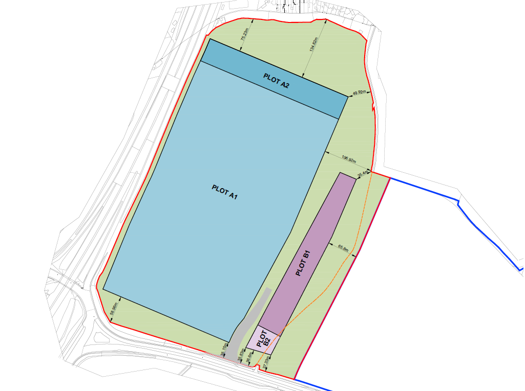
The “Development Zones”, where the employment buildings and other facilities are to be located, are applied for in outline as shown on the Parameters Plan and labelled as A1, A2, B1, B2. This means that the uses would be confirmed but full design details for the buildings would need to be approved by the Council through future “reserved matters” applications.
These future reserved matters applications would need to comply with the key elements listed above, as well as the detailed parameters set out in the accompanying Design Code.
An illustrative masterplan and illustrative images provided below indicate how the site could potentially be developed for a range of employment uses and hub office.
Illustrative image showing potential design of smaller industrial units targeted at local businesses and SMEs

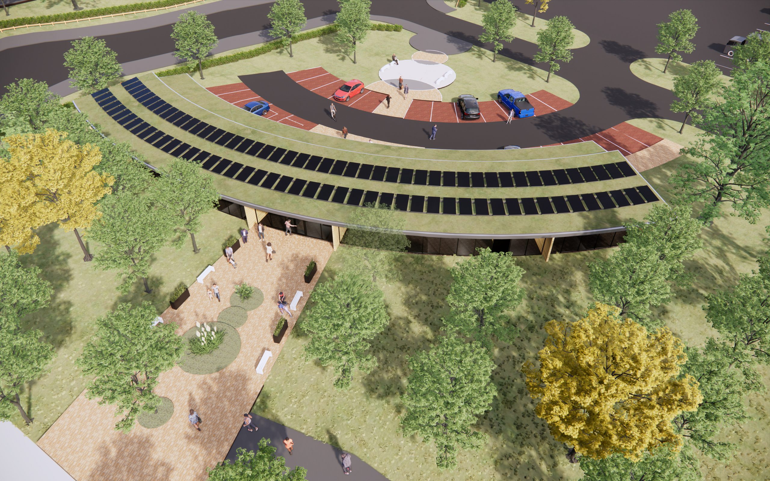
Illustrative image showing potential design of hub office
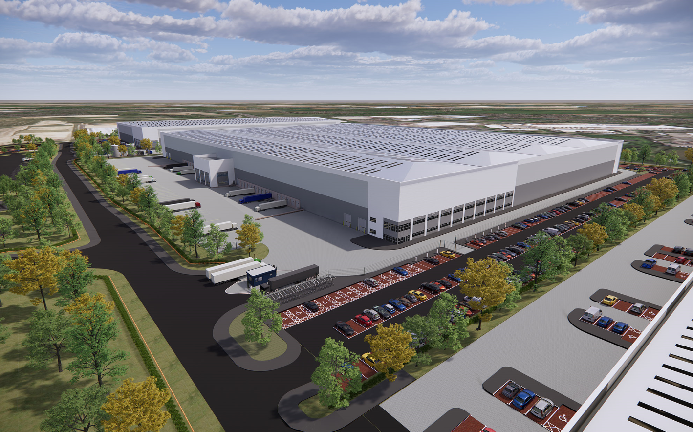
Indicative image showing potential design of warehousing
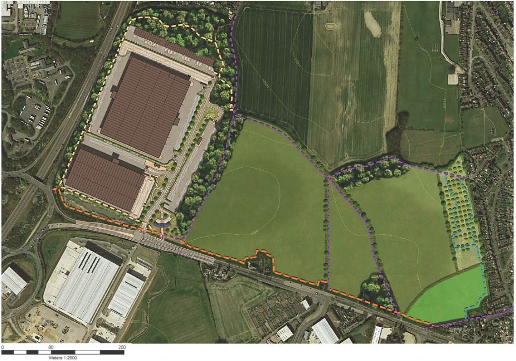
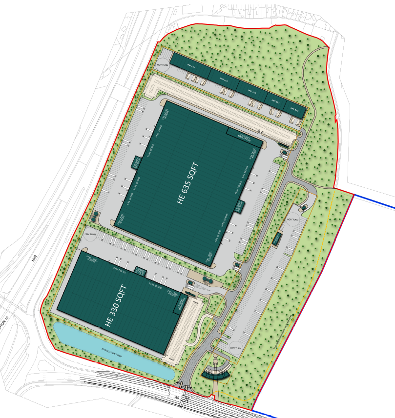
Indicative masterplan showing potential layout
Illustrative landscape masterplan